Sattelite missions such has SPOT-VGT and PROBA-V have been capturing the earth on a daily basis for more than 15 years. This has accumulated into a treasure trove of information on how regions in the world have evolved over this period. However, it has not always been easy to quickly extract useful information out of this archive, until now!
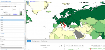
One of the applications offerred in the PROBA-V mission exploitation platform, is the 'Time Series Viewer'. This application tries to unlock the information in remote sensing archives, by enabling interactive querying on precomputed time series datasets. The fact that it is precomputed, means that this application does not offer information at the level of individual pixels, but at a higher level. We have selected the following levels of aggregation to be available:
- All CCI landcovers for GAUL level 1 administrative regions, for instance: grassland in provinces or states of a country.
- GAUL level 1 administrative regions
- All CCI landcovers for all countries of the world (GAUL level 0)
- All countries of the world.