Snow mapping

Delft University of Technology (TUDelft)
Department of Geoscience & Remote Sensing
Delft, The Netherlands
Contact Person
Stef Lhermitte
E : s.lhermitte@tudelft.nl
T : +31 15 27 85955
Summary
Snowmelt is an important and dynamically changing water resource in mountainous regions around the world. Within this project we plan to demonstrate and evaluate the potential of the PROBA-V data to accurately monitor snow cover in mountainous environments. By introducing correction algorithms that take into account topographic variability and variations in viewing geometry, we will develop methodologies that allow for more accurate snow mapping. The PROBA-V Mission Exploitation Platform (PV-MEP) will allow applying the developed methods on large amount of PROBA-V satellite data and will allow sharing the developed open-source algorithms.
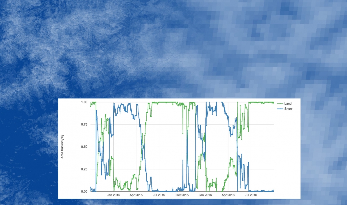 Figure 1: Example of snow mapping at different scale levels and snow map time series
Goal
The final goal is develop an improved snow-mapping algorithm that (better) accounts for topographic variations, where snow mapping sometimes still is complicated.
Technical contact person
Stef Lhermitte
E : s.lhermitte@tudelft.nl
T : +31 15 27 85955
Twitter: @steflhermitte